4 June 2024 news
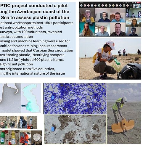
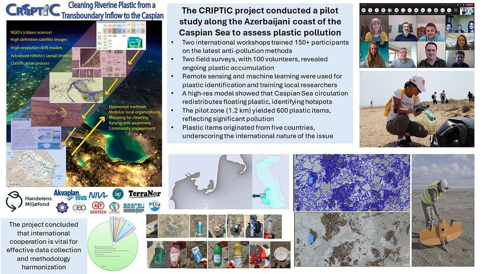
In the CRIPTIC project a team has conducted a pilot study in a selected location along the Azerbaijani coast of the Caspian Sea to identify the state of plastic pollution and analyze the whereabouts and the origin of different plastic items identified.
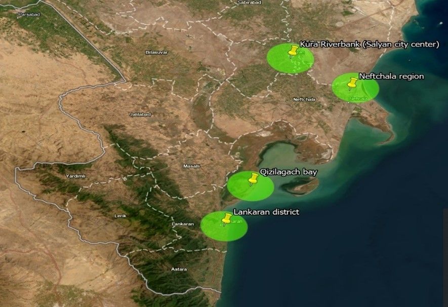
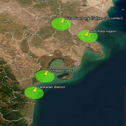
Distribution map of the inspected locations
The project was realized through two international workshops for capacity building and increasing public awareness in the region. More than 150 participants, mostly university students and early career scientists attend the workshop and were introduced to the latest protocols, methods, and developments in combating plastic pollution in Norway and internationally scope.
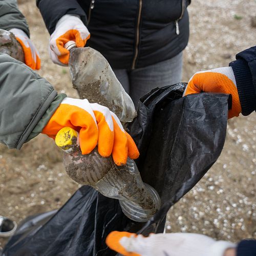
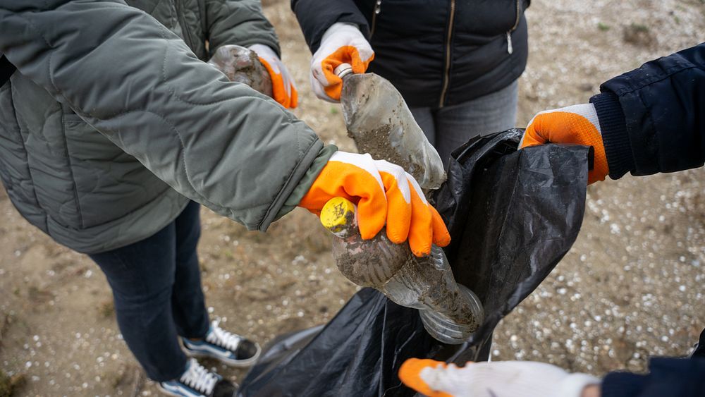
Two extensive field surveys aim to map for cleaning conducted, where approx. 100 volunteers took part. Within these activities, a pilot zone was mapped and cleaned up two times with a one-year time gap. The pilot zone surveyed and cleaned up in 2021. The same pilot zone was revisited in 2022 for inspection and clean-up.
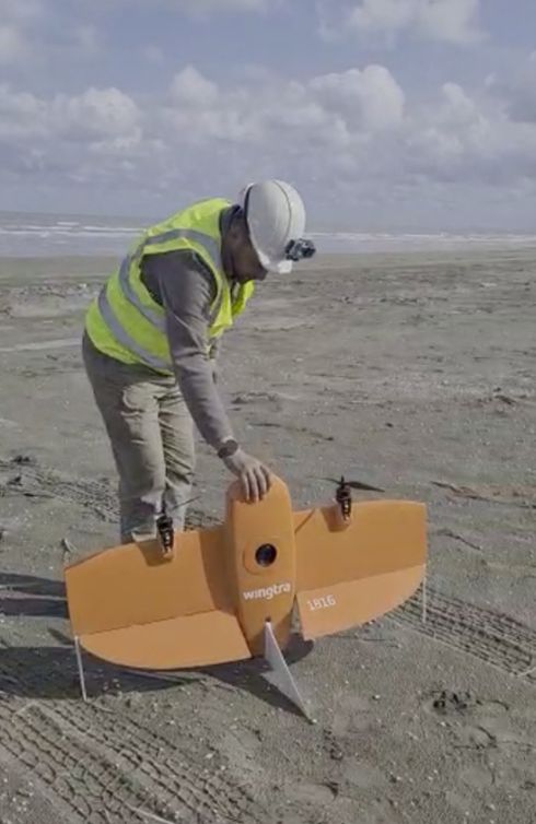
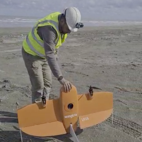
Wingtra One VTOL Fixed Wing drone preparation to work in CRIPTIC pilot zone located in Neftchala region on 5th of November 2022.
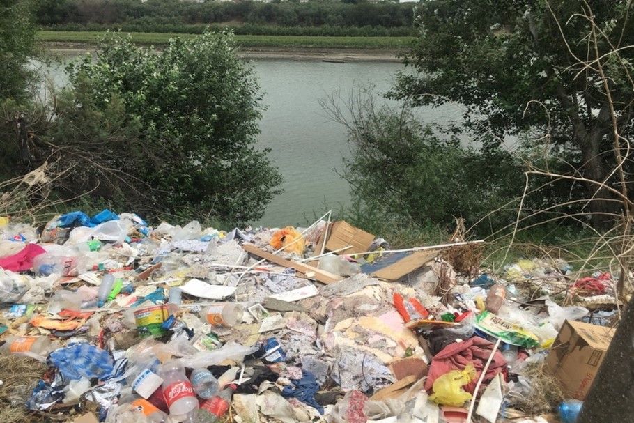
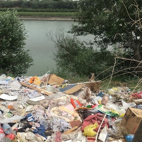
A snapshot of the Kura Riverbank at Salyan city
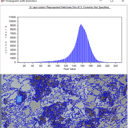
The number of items that were collected within the second survey was comparable (or larger) compared to the first fieldwork, which indicates a continuous and increasing pattern of accumulation of plastic debris. Remote sensing methods were adopted to the region and used for the identification of plastic items in the pilot zone. Additionally, local researchers and students trained in the application of machine learning and image processing for mesoplastic identification.
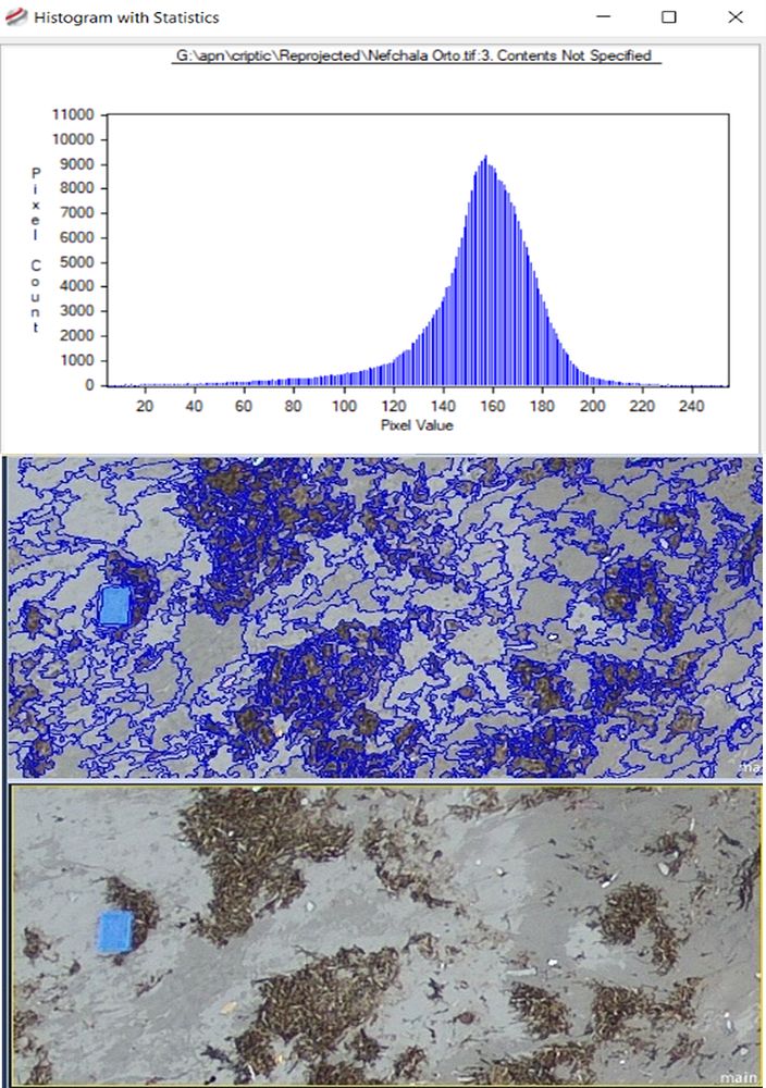
Drone image segmentation to identify objects that fit the colour value
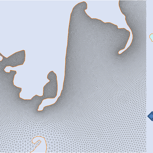
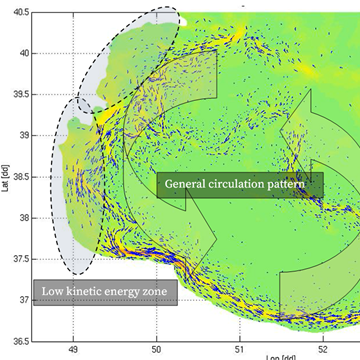
A high-resolution unstructured grid model was adopted for the Caspian Sea. The model results showed that the counterclockwise circulation of the Caspian Sea and rim currents are responsible for relocating and transporting the floating plastic items in the Caspian Sea. Low kinetic energy zones were identified based on the flowfield simulations, which could be considered as hot spots for plastic and marine debris accumulation areas.
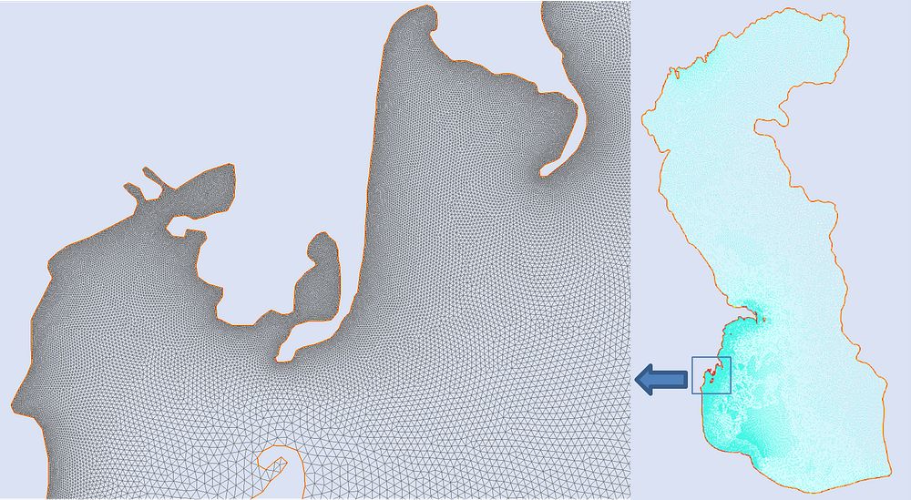
Overview of the Caspian Sea unstructured grid. The grid has highest resolution in the western side, where Kura River introduce plastics to the sea.
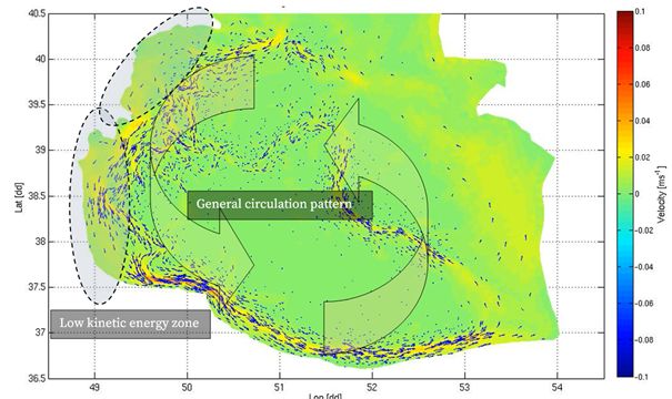
Plastic debris distribution pattern
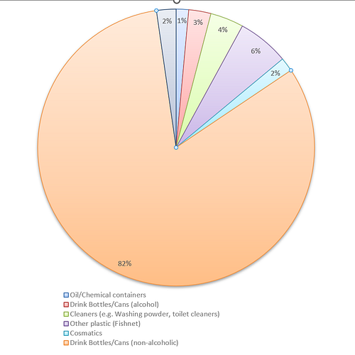
The length of the selected pilot zone within the CRIPTIC project was 1.2 km, which is very small compared to the total coastline of the Caspian Sea (approx. 6380 km). However, the project team managed to collect approx. 600 litter plastic debris, which can be an indication of the plastic pollution problem in the Caspian Sea region.The collected items from the pilot zone belonged to 5 different countries with and without coastline in the Caspian Sea, which again indicate the multi-national dimension of plastic pollution in the Caspian Sea.
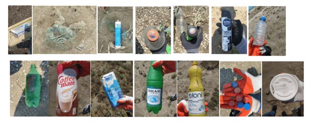
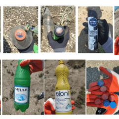
Different items of plastic litter
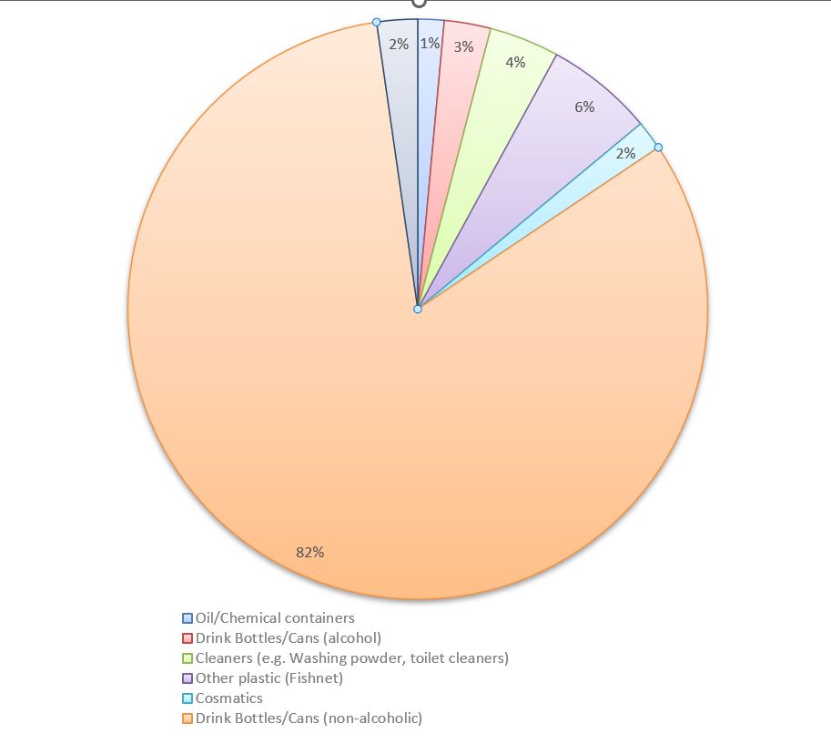
The identifies categories of collected plastic items.
The CRIPTIC project and its results were presented at the regional and international workshops and conferences, including the UNEP's 7th International Marine Debris Conference (7IMDC). The conclusion from the project, presented here and on other platforms, is that there is a need for international aid for coordinating data collection on marine litter at the national level and international levels in the Caspian Sea region. There is also a need to agree on and harmonize the methodology for data collection and mapping plastic waste, especially for the main plastic waste sources at the national level through international collaboration.
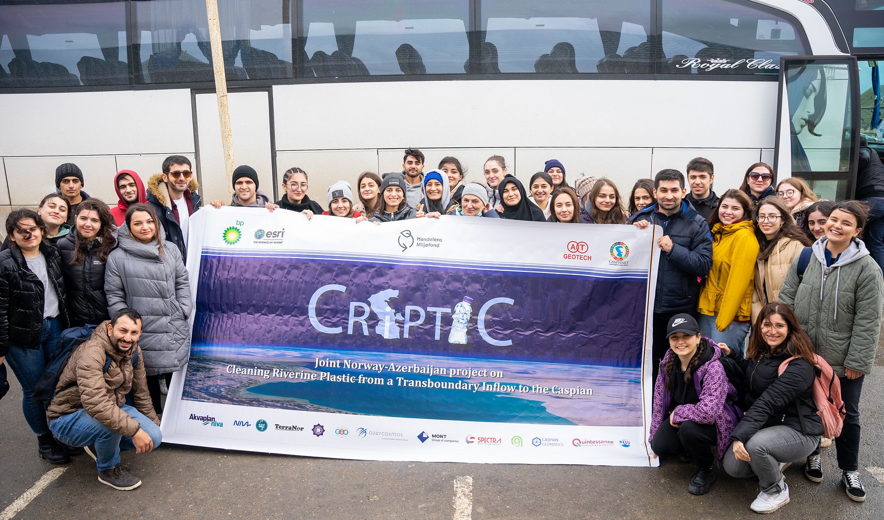
The project was fundend by the Norwegian Retailers' Environment Fund (Handelens Miljøfond) and led by Akvaplan-niva (Norway). The project partners are:
- The Norwegian Institute for Water Research (NIVA)
- SALT
- TerraNor
- Azerbaijanian Geographical Society (AGS)
- Institute of Geography of the Azerbaijan National Academy of Sciences (IGA)
- Sukanal SRDI of Azersu
- Water Expert Union (WEU)
- AT-Geotech
- Azercosmos
- Caspian Integrated Scientific Network (CASPISNET)
Folder presenting project results.